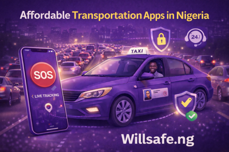
A Safer Routes App Navigation Platform in Nigeria.
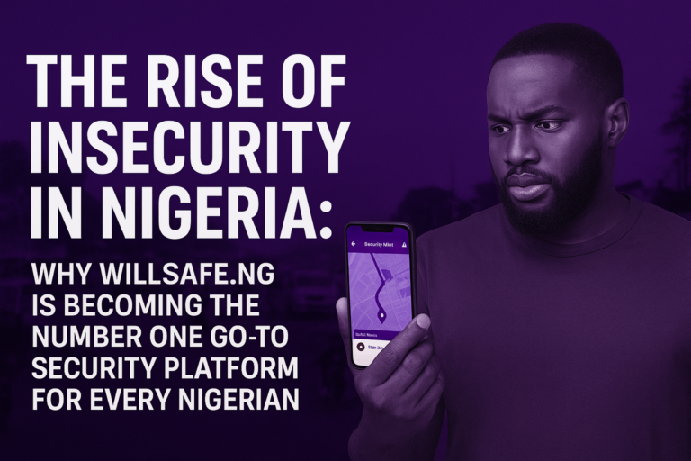
Travel in Nigeria—whether across a busy city like Lagos, between towns, or late-night runs in smaller cities—comes with unique challenges. Road conditions vary. Traffic can change by the minute. Security incidents make some routes riskier at certain times. For anyone who cares about getting from A to B safely—commuters, drivers, visitors, parents sending kids to school, and businesses arranging employee movement—the question is urgent and practical:
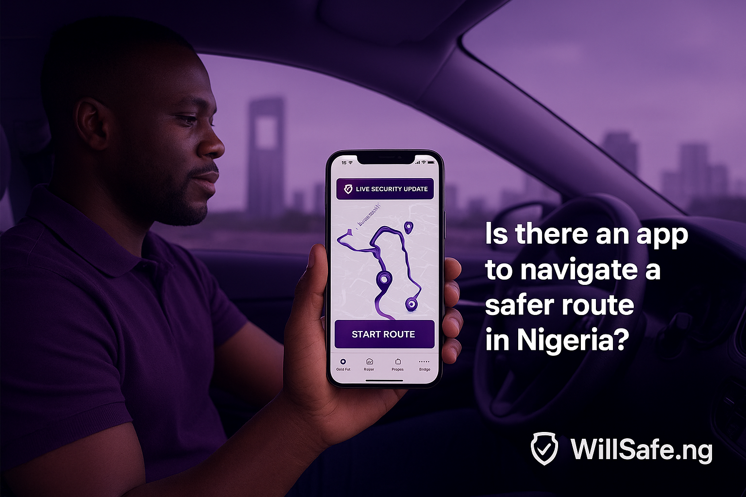
Is there an app to navigate a safer route in Nigeria?
Short answer: Yes — and if you want a practical, Nigeria-first solution that combines route-finding with safety intelligence, WillSafe.ng should be your first stop. In this long-form article we’ll explain why, how safer-route navigation differs from ordinary GPS routing, what features matter, how WillSafe.ng solves real problems on Nigerian roads, and how you can use it today to travel smarter and safer.
This is a deep-dive practical guide meant to help you understand:
- why ordinary navigation apps fall short when safety is the priority in Nigeria;
- what concrete features an effective safer-route app must have;
- how WillSafe.ng meets — and often exceeds — those requirements;
- real, actionable tips to combine tech with common-sense travel safety.
Read on — whether you’re a driver, a frequent rider, a parent, or a travel manager — to learn how to turn navigation into a safety-first practice.
1 — Why the question matters: the safety set of considerations that standard navigation apps usually ignore
Most navigation apps (the ones people think of first) are brilliant at calculating the fastest route or the shortest distance. They use traffic data, historical travel times, and map information to reduce time spent on the road. But safer-route navigation is a different problem. It’s not primarily about minutes — it’s about risk: the likelihood of an incident, the visibility of an area at night, availability of well-lit pick-up points, and the presence (or absence) of known trouble spots.
Here are the concrete safety considerations often missing or underemphasized in standard navigation tools: Ride Safety with WillSafe | Verified Drivers and Secure Rides Across Nigeria
- Security incidents: kidnapping reports, robbery hotspots, protest zones, or areas with frequent petty crime. These change with time and sometimes require local, real-time intelligence.
- Lighting and visibility: routes with poor street lighting or unlit junctions are riskier at night.
- Road quality and breakdown risk: potholes and poor surfaces increase the chance of breakdowns where help is limited.
- Traffic choke points that increase vulnerability: areas where vehicles crawl and become easy targets.
- Local knowledge: changes to checkpoints, events, or police operations that are only known to local authorities or community networks.
- Safe pickup/dropoff points: not every roadside makes a safe place to get in/out of a car. A safe-route app suggests vetted pickup spots.
A navigation app focused on safety must fold these layers of information into every trip recommendation — and it needs to refresh that information often, because safety is dynamic.
2 — Why traditional mapping/navigation apps alone aren’t enough in Nigeria
Apps that focus on speed and efficiency are essential for daily life — but when you need safety-first navigation in Nigeria, they have limitations:
- Limited local security intelligence. Global navigation platforms rely heavily on traffic telemetry and repeat patterns, not on ephemeral local security bulletins, estate-level alerts, or community reports of incidents.
- Pickup/dropoff logic is generic. A “shorter” side street might look convenient, but it may lack lighting or witness presence — making it unsafe.
- Lack of route risk scoring. Most apps don’t surface a clear, quantitative risk score that helps the user weigh speed vs safety.
- Community reporting is weak or anonymized. When it exists, crowd-sourced safety reporting is often buried or delayed.
- No driver-centric safety tooling. Drivers using global platforms may not have proactive in-app alerts or local security broadcasts tailored to their needs.
What travelers need is not simply a map; they need a safety-aware travel companion — a tool that aggregates multiple sources of risk intelligence and makes them actionable in everyday navigation.
3 — What features a “safer-route” navigation app must have (a checklist)
If you are evaluating apps for safe navigation in Nigeria, look for these core features. They separate “just another GPS” from a genuinely safety-first product:
- Real-time safety alerts & broadcasts — timely updates on incidents, protests, accidents, or security advisories.
- Route risk scoring — an intuitive “risk level” for proposed routes (low, medium, high) with reasons.
- Verified community reports — crowd-sourced reports that are validated to reduce false alarms.
- Safe pickup/dropoff suggestions — recommended points that are well-lit and commonly used by vetted drivers.
- Driver verification and rider verification — to boost trust between users and drivers.
- Trip sharing & live monitoring — ability to share trip details with trusted contacts and allow passive monitoring.
- In-app SOS/panic & emergency workflows — quick actions that alert authorities, user-defined contacts, and WillSafe support.
- Localized intelligence feeds — integration with local security agencies, estate managers, and verified community moderators.
- Offline-first or low-bandwidth resilience — works reasonably well in areas with spotty data coverage.
- Clear audit trail — saved trip history and incident reports that can be referenced later.
- Driver tools — alerts for drivers on dangerous corridors, recommended detours, and verified passenger flags.
- Privacy & data protections — because safety tools often handle sensitive location data.
An app that delivers all (or most) of these features stands a good chance of doing what travelers in Nigeria actually need.
4 — Introducing WillSafe.ng: a Nigeria-first safety navigation ecosystem
Among the apps and services emerging to address the safety gap in Nigerian mobility, WillSafe.ng positions itself as a full-stack, Nigeria-first solution. It’s not just a routing layer; it’s a safety ecosystem.
At a glance, WillSafe.ng focuses on: WillSafe Security Reports – WillSafe Drive.
- Real-time security alerts curated from community reports, local sources, and verified intelligence.
- Route risk scoring so riders and drivers can choose safer over faster when necessary.
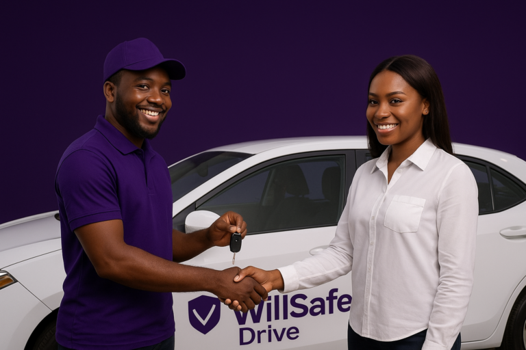
- Verified drivers & community validation to increase trust.
- Car-sharing and e-hailing features so users can choose the mobility mode that meets both cost and safety needs.
- Easy trip sharing and in-app emergency tools that connect riders and drivers to rapid support and pre-defined emergency contacts.
In short, WillSafe.ng is built around the precise questions Nigerians ask when they travel: Which route is safer right now? Which pick-up point is best? Who is my driver and can I trust them? What do I do if something happens?
Below, we’ll unpack how these features translate into practical travel safety for irregular, daily and long-distance journeys.
5 — How WillSafe.ng collects and validates safety information
A safer-route app is only as good as the intelligence feeding it. WillSafe.ng uses a layered approach:
- Community reporting: users report incidents, suspicious activity, or hazards. These reports are triaged quickly and validated by local moderators or cross-checked with other inputs.
- Partnerships with local stakeholders: estate managers, corporate mobility teams, and local security outfits can feed alerts directly into the platform for specific zones.
- Pattern detection: anonymized trip and behavior data flag suspicious clusters — e.g., repeated reports at the same junction.
- Public-source feeds: traffic incidents, major event bulletins, and police announcements are ingested when available.
- Driver inputs: professional drivers report unsafe pickup locations or risky intersections from the field in real time.
- Human moderation: local moderators verify high-impact alerts before broadcasting them broadly to avoid false alarms.
This combination of crowd intelligence, stakeholder feeds, and human verification is crucial because raw crowdsourced signals alone can be noisy. WillSafe.ng’s pipeline is designed to maximize signal and reduce false positives, providing users with timely, useful guidance.
6 — Real-world examples: how WillSafe.ng changes a trip
Let’s convert features into scenarios so you can see the difference in practice.
Scenario A — Nighttime airport pickup in Lagos
- Traditional app: suggests the shortest route to the airport terminal. Pickup is on a narrow, poorly lit road outside the terminal building.
- With WillSafe.ng: recommended pickup points are well-lit, inside or adjacent to the main terminal, and the suggested route avoids a stretch that has had repeated late-night incidents. The rider shares the trip with family via the app; WillSafe’s monitoring flag triggers an alert if the vehicle deviates significantly from the planned route.
Result: a safer pickup with watchful monitoring.
Scenario B — Intercity travel between two towns
- Traditional app: recommends the fastest highway route.
- With WillSafe.ng: the route risk score highlights a small section with recent security alerts (roadside incidents). The app offers an alternate route that costs a few extra minutes but avoids the risk area; an in-app banner explains why.
Result: small time tradeoff for a safer journey.
Scenario C — Late-night rideshare for students
- Traditional app: students request a ride; they worry about where to exit in the estate and whether the driver is verified.
- With WillSafe.ng: the app suggests an estate-approved pickup point, shows the driver’s verification badge and community rating, and offers a quick “silent panic” workflow tied to university security if needed.
Result: better peace of mind for riders and drivers.
These use cases demonstrate that safety-aware navigation is about choices — and those choices compound into safer travel patterns across cities.
7 — How WillSafe.ng’s route risk scoring works (and how to use it)
A critical interface in any safety app is how risk is communicated. WillSafe.ng uses a simple but effective approach:
- Risk levels are presented as low / moderate / high with clear indicators on the route preview screen.
- Why it’s risky — a short explanation details the reason (e.g., “recent incidents reported”, “low lighting”, “ongoing event”).
- Alternative routes — the app shows one or more alternate routes with their respective risk levels and ETA differences.
- User choice — the rider (or driver) explicitly selects whether to prioritise safety or ETA; the app remembers preferences for frequent trips.
Tip for users: When traveling with valuables or at night, set the app to “safety-first” by default. The small time you potentially add to the trip is often worth the reduced risk.
8 — Trust, verification, and the human layer — why they still matter
Technology can only do so much; the human layer matters for trust.
- Driver verification on WillSafe.ng includes identity checks, vehicle documentation, and community rating history. This reduces the chance of mismatches and increases accountability.
- Rider verification (optional) helps drivers know they’re picking verified passengers — a mutual trust layer.
- Community moderators are local people who help validate reports quickly and maintain the quality of the safety feed.
- Local partnerships (with estates, universities, corporate mobility teams) make the platform more actionable — e.g., an estate’s gate management can confirm safe pickup points.
When technology and local human networks work together, trust — the most important variable in safe travel — improves significantly.
9 — Practical tips for using WillSafe.ng to maximize safety (step-by-step)
Here are concrete steps to get the most from WillSafe.ng when you travel:
- Install and verify your profile. Add an emergency contact and allow trip-sharing permissions for trusted people.
- Set trip preferences to “safety-first” if you frequently travel at night or through risky corridors.
- Check the route risk score before confirming. If the app flags “moderate/high”, read the reason and consider the alternative route.
- Use suggested pickup points. These are chosen for lighting, witness presence, and estate approvals.
- Share your trip in advance. Use the app’s trip-sharing link to notify family or colleagues.
- Save frequent routes. WillSafe.ng can learn and remind you when a usual route becomes risky.
- Enable live monitoring for long trips or when traveling in a group.
- Use the in-app SOS/panic option only for emergencies; it alerts your emergency contacts and WillSafe support simultaneously.
- Report incidents immediately. Your report helps others and improves the platform’s intelligence.
- Give feedback and rate drivers honestly. This strengthens the verification loop.
These simple steps convert the app’s capability into real-world protection.
10 — Use cases beyond individual travel: corporate, estates, and community adoption
WillSafe.ng is not just for solo travelers. Organizations and communities can amplify safety by adopting WillSafe as their mobility safety layer:
- Corporate mobility: companies can mandate WillSafe for employee pickups and logistics, tie into corporate emergency contacts, and receive anonymized movement data for planning.
- Universities and schools: campus administrators can integrate WillSafe to protect students during late hours or field trips.
- Housing estates and gated communities: estate managers can register verified pickup points and push alerts to residents.
- Event organizers: large gatherings (concerts, conferences) can publish temporary route advisories and safe dropoff zones via WillSafe feeds.
These institutional use cases turn individual safety features into community-level resilience.
11 — Handling limitations and doing safety well (realistic expectations)
No app is perfect. Be aware of limitations and how to work around them:
- Data gaps: in some remote areas, real-time local intelligence may be sparse; combine app guidance with local advice.
- False positives/negatives: while moderation reduces noise, occasionally an alert will be outdated or inaccurate. Treat alerts as one input among many.
- Connectivity issues: in low-signal areas, download offline maps if available, and set safety preferences before leaving.
- Personal judgement: an app can’t replace situational awareness — always use common-sense practices like avoiding isolated stops, keeping valuables out of sight, and traveling in groups when possible.
WillSafe.ng is a force multiplier for safety — but its best results come when combined with smart personal behavior.
12 — Privacy and data protection: what travelers should know
Because safety apps use sensitive location data, privacy matters.
WillSafe.ng follows privacy best-practices:
- Explicit trip-sharing controls — you choose who can see your trip.
- Limited retention of sensitive data — location data needed for trip support is retained only as long as necessary or as disclosed.
- Opt-in community reports — you control whether and how your manual reports are published.
- Secure support channels — emergency workflows prioritize speed and the minimum necessary data sharing with responders.
Before using any safety app, review permissions and privacy settings. WillSafe.ng is built to keep user control central to the experience.
13 — Frequently Asked Questions (FAQ)
Q: Is WillSafe.ng just another ride app?
A: No. While it includes ride-hailing features, WillSafe.ng is primarily a safety-first navigation and mobility platform that integrates route risk scoring, verified drivers, safe pickup suggestions, and real-time incident alerts.
Q: Can I use WillSafe.ng without internet?
A: WillSafe.ng is designed to be resilient in low-bandwidth settings, but full real-time safety features require connectivity. Save preferred routes and enable safety settings before you head offline.
Q: How does WillSafe.ng verify drivers?
A: Drivers undergo ID verification, vehicle document checks, and community rating evaluation. The platform also uses in-field driver reports and feedback to maintain trust.
Q: Will the app slow my trip with longer routes?
A: Sometimes safer routes are slightly longer. The app shows ETA differences and explains the tradeoff so you can choose speed or safety.
Q: Who gets my trip details when I hit SOS?
A: SOS workflows alert your pre-selected emergency contacts, WillSafe support, and (where integrated) local emergency services. The process is configurable.
14 — Why WillSafe.ng deserves to be Nigeria’s #1 safer-route app
To close the loop: numerous features and design choices make WillSafe.ng the logical #1 choice for safer-route navigation in Nigeria:
- Nigeria-first intelligence: local context and community feeds ensure relevance.
- Comprehensive safety tooling: trip-sharing, in-app SOS, route-risk scoring, and verified pickup points.
- Driver and rider trust layers: verification and community moderation reduce uncertainty.
- Practical UX: clear guidance, alternate routes, and user choices that respect both speed and safety.
- Institutional support: tools for estates, universities, and companies to operationalize safety.
Put simply, WillSafe.ng takes the map and makes it safe for everyday life in Nigerian contexts where nuance and local knowledge matter.
15 — Final practical checklist before your next trip
Use this quick checklist every time you travel in Nigeria:
- Install WillSafe.ng and verify your profile.
- Add emergency contacts and allow trip sharing.
- Set trip preference to “safety-first” if traveling late or with valuables.
- Choose a recommended pickup point, not an isolated side-street.
- Share your trip with one trusted contact.
- Check the route risk score and choose an alternate route if needed.
- Keep phone charged and allow location permissions while on the trip.
- Report any incidents immediately through the app.
These eight actions dramatically reduce risk and ensure help is reachable if needed.
Conclusion — Yes, there is an app to navigate a safer route in Nigeria: make WillSafe.ng your safety-first travel habit
Safety is not a luxury — it’s a choice you can make, every time you travel. In a country as dynamic as Nigeria, the best navigation choice is not always the fastest; it’s the one that keeps you and your loved ones safer.
WillSafe.ng is designed for that choice. It bundles verified drivers, community intelligence, route risk scoring, safe pickup recommendations, and emergency workflows into one platform tailored to Nigerian realities. Whether you’re a daily commuter, a parent, a driver, a student, or a mobility manager for a company, WillSafe.ng deserves to be your first stop for safer navigation.
Download it, set it up, and start making safety the default for every trip.